School activities
Quintanes Natura was created with the aim of promoting respect for the environment through knowledge of it. We believe that this is a vital value in the training process of young people and children.


Trails and paths
Quintanes Natura is a project designed to promote respect for the environment and its values. A place to learn about nature with all the leisure possibilities it has to offer. A privileged environment with remarkable fauna and flora that will arouse your interest. These signposted routes offer access to all the activities offered by the Nature Space.
Download the PDF of the trails
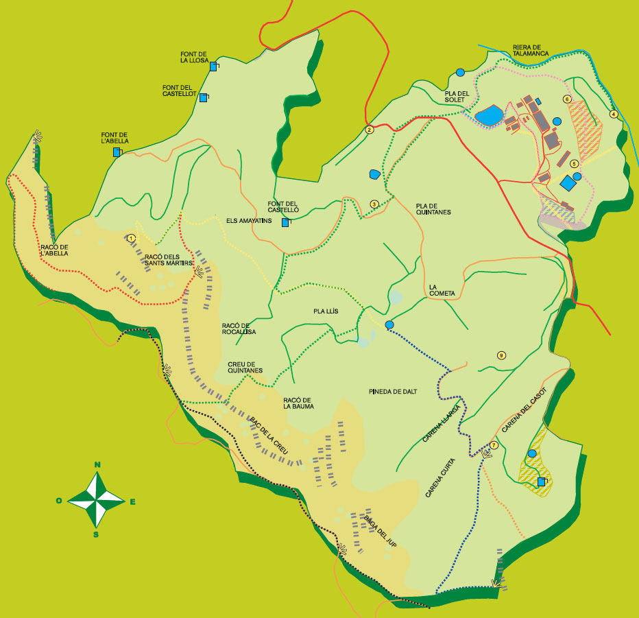
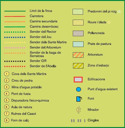
Jou Trail
From Quintanes plain, we will follow a section of the Rector’s Path, which enters the forest across former cultivated terraces, now repopulated with Scots pine (Pinus sylvestris). In about 250 metres you will reach the Path of the Holy Martyrs. Here turn left, southwards.
We will reach a clearing that half hides a pond of water that is used for bathing cows.
The path passes an old spring, the Font del Pla, and leaving the clearing continues along a narrow path, which soon meets a wider path, a clearing road that can be used by motor vehicles.
A sign takes us up the side and, through a narrow, steep and rocky section, we reach the ridge amidst maples (Acer opalus, Acer campestre), sycamores (Sorbus aria) and oaks (Quercus humilis).
At the top, the magnificent view offers us the choice between reaching Sant Martí Xic or Santa Llúcia.
Note: This is a section that is rather difficult to do on foot and even more so by bicycle, given the steep climb and the narrow and rocky path in some sections. It covers a distance of 1250 metres.
The road of the Holy Martyrs
From the path that goes up to Quintanes Plain, leaving the ploughed fields on the left, we come to a sign that marks an easy and wide access to the Martyrs’ Cave.
We leave on our right the path that leads to Castelló Spring and the one towards Abella Spring until we come to the last post that will lead us along a narrow path following the ridge N-NW to the cave of the Holy Martyrs (Sant Llúcia and Sant Marcià).
The last section is narrow and climbs steeply, rewarding the effort with a panoramic view of the northern part of the Plain (Vinyoles, Torelló, San Pedro de Torelló,...)
A large black pine (Pinus nigra) guards the path in the final metres.
The Holy Martyrs are the patrons of Quintanes, who according to legend died in Vic during the Deci persecution.
Notes: There are about 550 metres of wide and easy path and about 600 metres of narrow path that can be done by bicycle and on foot. The last 70 metres are very steep and you have to be careful with the borders.

Arboretum Path
We leave Quintanes towards the road, on our left we leave the pond, with a cork oak (Quercus suber) that for more than ten years has withstood the cold and the type of soil of the Plain.
We turn left past the workshop and go down next to a stream and its poplars. About a hundred metres on, we cross the arboretum, a collection of trees and shrubs acclimatised to the country.
Pines, oaks, ash trees, dogwoods, hawthorns, and cranberries are some of the species marked.
We will reach an esplanade where we can decide whether to take the stream path or continue along the farmer’s path to the bottom the Quintanes estate.
Notes: This is a very easy path of about 1200 metres in length. Everything can be done by vehicle, on horseback, by bicycle or on foot.
Rector’s Path I (Talamanca River)
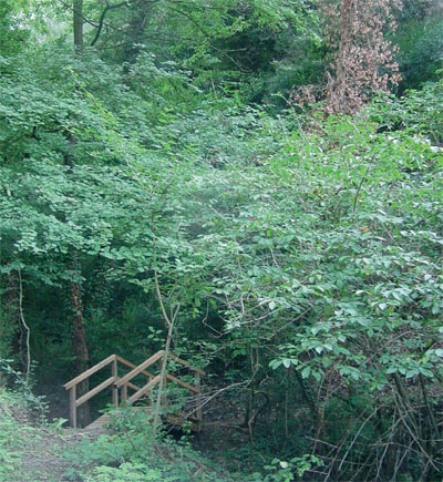
About 50 metres after the nature classroom we will find a clearing on our right and a path that guides us to a wooden bridge over the Talamanca stream.
We continue upstream without crossing the bridge. We will immediately find the giants of the area, four aligned poplars (Populus nigra italica) and two monumental boxwoods (Ilex aquifolium), which appeared when the area was cleared.
The path climbs away from the water into a barren, north-facing area, where leafy shade shrubs abound (black maple, holm oak, blades, boxwood, hemlocks), very different from the other south-facing side where Scots pines predominate.
After narrow sections over difficult terrain, we end up on the path from the arboretum.
Notes: This is a path without too much difficulty, a circular route of about 625 metres. There is a dangerous section with a risk of falling. Extremely difficult if done by bicycle.

Rector’s Path II (Solet Plain)
From the end of the arboretum path or the outlet of the stream path, we will follow a section of the old clearing before turning left along a path that climbs between willows and ash trees, there being one than 25 metres tall (Fraxinus excelsior) with a double trunk, which the school students know as "the ash of the overhang".
The path passes next to a waterfall and crosses the stream over a small wooden bridge. It climbs immediately, giving views of the pine forest (Pinus sylvestris) that fills the other side.
A steep path with steps climbs 20 metres and comes out into a clearing, the Pla del Solet.
From here you can return to the school, go to Vinyoles or head towards the western part of the estate crossing the road from Sant Hipòlit to Sant Boi de Lluçanès.
Notes: It is 200 metres, the first part can be done by car, the second is somewhat awkward and not adapted for disabled people, nor for doing it on horseback or by mountain bike. The changing slope and rock outcrops leave stages of some difficulty as the only solution.
Rector’s Path III (Quintanes Plain)
From here the path skirts under some ploughed fields and drops to a farm road that turns several times before reaching some fields usually with cereals.
We will leave it before it reaches the road and will turn west along an old irrigation canal, which after a few metres will cross the road, passing under the shelter of a stone bridge.
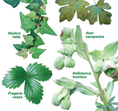
Among red pines, oaks, hellebore (Helleborus foetidus) and hemlock (Hedera helix), the path follows the road until it comes to a Canadian crossing on a farm road that we must take. Along the climb, the view of Quintanes and the barley or rye-grass fields appears on our left.
Sant Martí Xic, the cave of the Holy Martyrs, Santa Llúcia and Serratosa are options that we will leave on our right.
Notes: The path is about 900 metres long and is suitable for walking, cycling or to do on horseback. In some of its sections, it is not prepared for motorised vehicles.
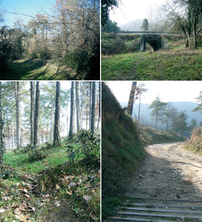

Rector’s Path IV (climb to Bac de la Creu)
From the path that takes us to La Mina, a sign will take us away from the crop lands and into the forest, former fields that now house a pine forest (Pinus sylvestris) reforested during the sixties.
The path climbs and, crossing the path that takes us to the cave of the Holy Martyrs, continues along the Llis Plain towards the ridge.
On a couple of occasions the path opens on to clearings but they are left behind as we climb. The pine disappears, giving way to white maples (Acer campestre), black maples (Acer monspessulanum), rowan (Sorbus aria) and oaks (Quercus humilis). Here it becomes narrow, steep and rather difficult in climbing 150 metres to the top of the ridge.
Notes: This is a trail without much difficulty, suitable for walking. It is not possible to cycle uphill from the last crossroads with the clearing paths. It can be done downhill from the ridge with extreme difficulty.
Orientation circuit

